
Planning a trip often means sorting through endless recommendations and outdated maps, hoping for a clear path through unfamiliar territory. For solo explorers and families from Europe and Asia, efficient travel planning can feel like a puzzle with too many missing pieces. With the rise of interactive mapping powered by Geographic Information Systems, you can now explore destinations with real-time updates, precise layers, and customizable options that make every journey smoother and more informed.
Table of Contents
- Defining Interactive Map Planning And Its Role
- Key Types Of Interactive Map Planning Tools
- How Interactive Maps Enable Personalized Itineraries
- Common Mistakes And Limitations In Map Planning
- Comparing Interactive Maps To Traditional Trip Planning
Key Takeaways
| Point | Details |
|---|---|
| Interactive Maps Enhance Travel Planning | They provide dynamic, real-time information that allows for personalized itineraries and informed decisions. |
| Advanced Tools Offer Diverse Features | Utilizing web-based and professional software can significantly improve spatial analysis and user customization. |
| Awareness of Common Mistakes is Crucial | Understanding potential pitfalls, such as data quality issues and visualization errors, can improve the effectiveness of map planning. |
| Combining Digital and Traditional Methods is Ideal | Leveraging both interactive and traditional tools maximizes navigation flexibility and spatial understanding. |
Defining Interactive Map Planning and Its Role
Interactive map planning represents a revolutionary approach to spatial navigation and travel strategy, transforming how travelers explore and understand destinations. At its core, interactive mapping uses Geographic Information Systems (GIS) to provide dynamic, layered visual representations of geographical data that go far beyond traditional static map designs.
Unlike conventional maps, interactive mapping systems offer sophisticated features that dramatically enhance user experience and information accessibility. These advanced systems enable travelers to:
- Zoom into specific locations with precision
- Layer multiple types of geographical information
- Update data in real-time
- Link to external supporting content
- Customize views based on personal travel preferences
The technological backbone of interactive map planning lies in its ability to visualize complex spatial relationships dynamically. Interactive Planning Support Systems facilitate knowledge exchange and collaborative decision-making, allowing travelers to engage more deeply with destination information.
Travelers can now transform abstract geographical data into actionable insights, understanding not just the physical layout of a destination, but its cultural, historical, and experiential dimensions. These systems support evidence-based travel planning by presenting spatial and temporal changes in an intuitive, visually compelling format.
Pro tip: Before your next trip, explore interactive map platforms that offer multi-layered destination insights to unlock hidden travel opportunities and plan more immersive journeys.
The following table summarizes how different users might benefit from key interactive map features:
| User Type | Most Valuable Feature | Primary Benefit |
|---|---|---|
| Casual Traveler | Real-time data update | Accurate, current trip info |
| Travel Planner | Layered info visualization | Quick comparison of options |
| Urban Researcher | Data integration | Advanced spatial analysis |
| Small Business | Custom views | Targeted marketing strategies |
Key Types of Interactive Map Planning Tools
Interactive map planning tools have revolutionized how travelers and professionals approach spatial data visualization, offering a diverse range of solutions to meet different needs and expertise levels. Web-based and desktop mapping tools provide unique capabilities for creating, analyzing, and sharing geographical information across various contexts.
The primary categories of interactive map planning tools include:
-
Web-based Platforms
- Google Fusion Tables
- Mapbox
- GeoCommons
-
Professional Geographic Software
- ArcGIS Pro
- QGIS
-
Interactive Visualization Tools
- Tableau
- Google Earth
Top mapping software tools in 2025 are distinguished by several key features that enhance user experience and data manipulation. These tools offer advanced capabilities such as 3D mapping, sophisticated data integration, customizable symbology, and powerful automation features.
Each mapping tool serves specific user requirements, ranging from simple location pinpointing to complex spatial analysis. Professional-grade tools like ArcGIS provide comprehensive features for researchers and urban planners, while more accessible platforms like Mapbox cater to individual travelers and small teams seeking intuitive mapping solutions.
Pro tip: Evaluate your specific mapping needs by testing multiple tools and selecting the one that balances functionality, ease of use, and cost-effectiveness for your travel planning.
How Interactive Maps Enable Personalized Itineraries
Personalized travel planning has been transformed by advanced technological approaches that leverage spatial data and user preferences. Hybrid itinerary generation systems now integrate sophisticated algorithms that break down traveler requests into customized, optimized routes tailored to individual needs and interests.
The key components of personalized itinerary creation include:
-
Preference Analysis
- Natural language processing
- User interest mapping
- Behavioral pattern recognition
-
Route Optimization
- Spatial clustering techniques
- Dynamic point of interest selection
- Real-time distance calculations
-
Customization Factors
- Travel time constraints
- Budget limitations
- Personal mobility requirements
- Cultural and culinary preferences
Personalized pathway methodologies enable travelers to create multiple potential routes that adapt to their specific objectives. These advanced systems utilize data tracking and visualization tools to continuously refine and optimize travel experiences, ensuring that each itinerary is as unique as the individual planning the journey.

By breaking down complex travel planning into intelligent, data-driven processes, interactive maps transform traditional navigation from a static experience into a dynamic, personalized adventure. Travelers can now craft routes that reflect their individual preferences, energy levels, interests, and practical constraints with unprecedented precision and ease.
Pro tip: Always input multiple preference parameters when generating your travel itinerary to ensure the most comprehensive and personalized route possible.
Common Mistakes and Limitations in Map Planning
Interactive map planning is not without its challenges, and understanding potential pitfalls is crucial for creating effective and reliable travel resources. Cartographic design challenges reveal complex technical and organizational obstacles that can significantly impact map quality and user experience.
The most common mistakes in map planning include:
-
Data Quality Issues
- Inconsistent information sources
- Outdated geographic data
- Incomplete location details
-
Visualization Errors
- Overcrowded map interfaces
- Inappropriate color schemes
- Mismatched map type selections
-
Technical Limitations
- Platform compatibility problems
- Scalability constraints
- Performance bottlenecks
Cartographic best practices emphasize the importance of clarity and precision in spatial data representation. Travelers often encounter maps that suffer from information overload, where excessive data points and unnecessary visual elements obscure critical navigation information.
Technical constraints can further compromise map planning effectiveness. Organizational limitations such as financial restrictions, legal complexities, and data confidentiality challenges create additional hurdles in developing comprehensive and accurate interactive mapping solutions. These multifaceted obstacles require sophisticated approaches to ensure reliable and user-friendly travel navigation tools.
Pro tip: Always validate your map’s data sources and simplify visual elements to maintain maximum clarity and user comprehension.
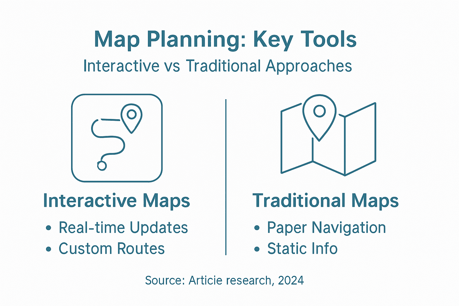
Comparing Interactive Maps to Traditional Trip Planning
Travel navigation has undergone a significant transformation, with digital technologies challenging long-established planning methods. Digital versus traditional map experiences reveal a complex landscape of technological innovation and historic navigation techniques.
Key differences between interactive and traditional trip planning include:
-
Traditional Trip Planning
- Physical map reliance
- Static geographic information
- Manual route tracking
- Limited real-time updates
-
Interactive Digital Planning
- Dynamic routing capabilities
- Real-time location tracking
- Multi-layer information access
- Instant route modifications
-
Comparative Advantages
- Technology accessibility
- Customization potential
- Multimedia integration
- Global connectivity
Digital itinerary planning strategies demonstrate significant advantages in efficiency and engagement. Digital tools provide unprecedented flexibility, allowing travelers to adapt plans instantaneously, integrate multimedia content, and access information across multiple devices.
While interactive maps offer remarkable technological capabilities, traditional maps retain unique value in providing comprehensive geographic literacy and offering a tangible connection to spatial understanding. The optimal approach often involves leveraging both digital and traditional navigation methods, recognizing the strengths of each technological paradigm.
Here’s a direct comparison of challenges faced in interactive map planning vs. traditional approaches:
| Issue Type | Interactive Maps | Traditional Maps |
|---|---|---|
| Data Timeliness | Instantly updated | Only update with reprints |
| Accessibility | Requires internet and devices | Usable offline anywhere |
| Error Impact | Technical glitches affect accuracy | Human error in manual planning |
| Customization | Highly customizable | Limited personalization |
Pro tip: Combine digital interactive maps with traditional navigation techniques to create a comprehensive and robust travel planning strategy.
Unlock the Power of Interactive Map Planning with MapsByEma
Interactive map planning transforms travel by offering dynamic, personalized routes that adapt to real-time data and your unique preferences. If you find yourself overwhelmed by outdated maps or cluttered visualizations, MapsByEma provides an effortless solution to these challenges. Our platform applies the core principles of interactive mapping highlighted in the article, such as layered geographical information and real-time updates, enabling you to craft tailored itineraries without wasting hours on research.
Experience how MapsByEma combines curated destination maps with intuitive digital tools designed for solo travelers, families, foodies, and adventurers alike. Save time while exploring must-see attractions, hidden gems, hikes, and local food spots—all accessible through a seamless browser-based platform with no downloads required. Whether you want quick access to comprehensive maps for Europe or Asia, or you need a personalized journey crafted around your travel goals, MapsByEma makes it straightforward.
Unlock your next adventure today by visiting MapsByEma, where interactive map planning meets ease and personalization.
Ready to transform your trip planning with expert-curated interactive maps Explore how MapsByEma delivers continuously updated content to help you build and download customized itineraries Visit MapsByEma now and start planning smarter travel routes that reflect your distinct interests and schedule.
Frequently Asked Questions
What is interactive map planning?
Interactive map planning is a modern approach to spatial navigation that uses Geographic Information Systems (GIS) to provide dynamic and layered visual representations of geographical data, allowing travelers to customize and enhance their exploration of destinations.
How can interactive maps enhance travel itinerary planning?
Interactive maps can enhance travel itineraries by offering features like real-time data updates, layered information visualization, and route optimization based on user preferences, leading to personalized and efficient travel planning.
What are some common mistakes to avoid when using interactive maps?
Common mistakes include relying on outdated data, cluttered visual interfaces, and not validating data sources, which can compromise the quality and usability of maps for effective navigation.
How do interactive maps compare to traditional trip planning methods?
Interactive maps differ from traditional methods by providing dynamic and customizable routes, real-time updates, and multi-layer information access, which improves efficiency and engagement compared to static maps that lack such features.


